Geolocate

Vatersay topographic map

Click on the map to display elevation.

About this map

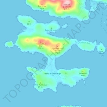
Name: Vatersay topographic map, elevation, terrain.

Location: Vatersay, Western Isles, Scotland, United Kingdom (56.90904 -7.58269 56.94925 -7.47433)

Average elevation: 62 ft

Minimum elevation: -3 ft

Maximum elevation: 971 ft

Gear up for your next adventure:

🧣Merino Neck Gaiters - Multi-functional headwear for wind and sun protection
🏕️Family Camping Gear - Essentials for group camping trips
🥾Men's Hiking Boots - Durable, waterproof footwear for rugged terrain and steep inclines
🌎3D Topographic Globes - Raised relief globes for a tactile understanding of geography
📶Satellite Messenger - Communication device off‑grid

As an Amazon Associate, this site earns from qualifying purchases at no extra cost to you.