
Sümer topographic map
Interactive map
Click on the map to display elevation.
About this map
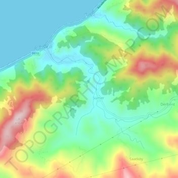
Name: Sümer topographic map, elevation, terrain.
Location: Sümer, Fındıklı, Rize, Black Sea Region, Turkey (41.26930 41.20015 41.30930 41.24015)
Average elevation: 466 ft
Minimum elevation: 0 ft
Maximum elevation: 1,342 ft