
Goomalling topographic map
Interactive map
Click on the map to display elevation.
About this map
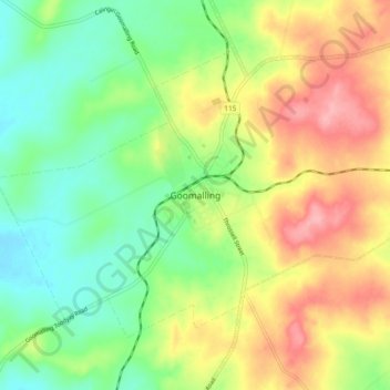
Name: Goomalling topographic map, elevation, terrain.
Location: Goomalling, Western Australia, 6460, Australia (-31.33970 116.78852 -31.25970 116.86852)
Average elevation: 840 ft
Minimum elevation: 679 ft
Maximum elevation: 1,053 ft
Other topographic maps
Click on a map to view its topography, its elevation and its terrain.
Goomalling
Australia > Western Australia > Goomalling
Goomalling, Shire Of Goomalling, Western Australia, 6460, Australia
Average elevation: 823 ft