
Fuente Dé topographic map
Interactive map
Click on the map to display elevation.
About this map
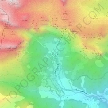
Name: Fuente Dé topographic map, elevation, terrain.
Location: Fuente Dé, Camaleño, Cantabrië, 39588, Spanje (43.12403 -4.83148 43.16403 -4.79148)
Average elevation: 4,938 ft
Minimum elevation: 2,799 ft
Maximum elevation: 7,802 ft