
Huise topographic map
Interactive map
Click on the map to display elevation.
About this map
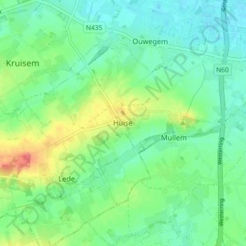
Name: Huise topographic map, elevation, terrain.
Location: Huise, Kruisem, Oost-Vlaanderen, Vlaanderen, 9750, België (50.87882 3.57078 50.91882 3.61078)
Average elevation: 82 ft
Minimum elevation: 20 ft
Maximum elevation: 217 ft