
Jerte topographic map
Interactive map
Click on the map to display elevation.
About this map
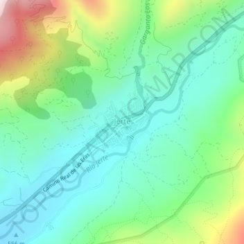
Name: Jerte topographic map, elevation, terrain.
Location: Jerte, Valle del Jerte, Cáceres, Extremadura, Spain (40.21898 -5.75672 40.22588 -5.74581)
Average elevation: 2,369 ft
Minimum elevation: 1,804 ft
Maximum elevation: 3,776 ft