
Twee Riviere topographic map
Interactive map
Click on the map to display elevation.
About this map
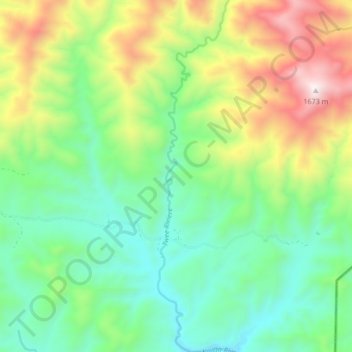
Name: Twee Riviere topographic map, elevation, terrain.
Average elevation: 3,133 ft
Minimum elevation: 1,913 ft
Maximum elevation: 5,518 ft
Other topographic maps
Click on a map to view its topography, its elevation and its terrain.
Kaaimans River
South Africa > Western Cape > George Local Municipality
Kaaimans River, George Local Municipality, Garden Route District Municipality, Western Cape, 6560, South Africa
Average elevation: 1,322 ft
Eersterivier
South Africa > Western Cape > George Local Municipality
Eersterivier, George Local Municipality, Garden Route District Municipality, Western Cape, South Africa
Average elevation: 2,434 ft