
Stelen topographic map
Interactive map
Click on the map to display elevation.
About this map
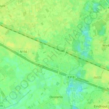
Name: Stelen topographic map, elevation, terrain.
Location: Stelen, Geel, Turnhout, Antwerpen, 2440, België (51.10403 4.95614 51.14403 4.99614)
Average elevation: 59 ft
Minimum elevation: 30 ft
Maximum elevation: 79 ft
Other topographic maps
Click on a map to view its topography, its elevation and its terrain.
Neerhelst - De Botten
België > Antwerpen > Turnhout > Geel
Neerhelst - De Botten, Gebeunt, Geel, Turnhout, Antwerpen, Vlaanderen, 2440, België
Average elevation: 49 ft
Winkelomheide
België > Antwerpen > Turnhout > Geel
Winkelomheide, Geel, Turnhout, Antwerpen, Vlaanderen, 2430, België
Average elevation: 62 ft