Geolocate

Kuppam topographic map

Click on the map to display elevation.

About this map

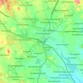
Name: Kuppam topographic map, elevation, terrain.

Location: Kuppam, Chittoor, Andhra Pradesh, 517425, India (12.70523 78.30433 12.78523 78.38433)

Average elevation: 2,264 ft

Minimum elevation: 2,096 ft

Maximum elevation: 2,644 ft

Gear up for your next adventure:

🧭Outdoor Navigation Book - Learn advanced navigation skills
🌧️Backpack Rain Cover - Keep gear dry in wet weather
🏕️Family Camping Gear - Essentials for group camping trips
🎁Geography Themed Gifts - Unique gift ideas for map lovers and geography enthusiasts
🧤Tactile Hiking Gloves - Keep hands warm while operating GPS and smartphone screens

As an Amazon Associate, this site earns from qualifying purchases at no extra cost to you.