Geolocate

Richmond topographic map

Click on the map to display elevation.

About this map

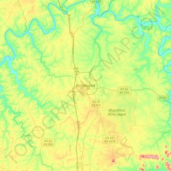
Name: Richmond topographic map, elevation, terrain.

Location: Richmond, Madison County, Kentucky, 40475, United States (37.58786 -84.45465 37.90786 -84.13465)

Average elevation: 876 ft

Minimum elevation: 548 ft

Maximum elevation: 1,480 ft

Madison County trails, hiking, mountain biking, running and outdoor activities

Gear up for your next adventure:

🔌USB Car Charger - Car charger for on‑the‑go power needs
🪓Survival Multi‑Tool - Versatile tool for camp and trail tasks
🗃️Trail First Aid Kit - Essential kit for outdoor injuries and emergencies
🧢Outdoor Hiking Hat - Sun protection hat for outdoor explorers
🔥Camping Stove - Portable stove for camping and backcountry cooking

As an Amazon Associate, this site earns from qualifying purchases at no extra cost to you.