
Ngahere topographic map
Interactive map
Click on the map to display elevation.
About this map
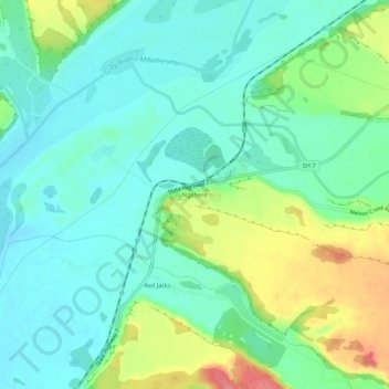
Name: Ngahere topographic map, elevation, terrain.
Location: Ngahere, Grey District, West Coast, 7804, New Zealand (-42.41513 171.42319 -42.37513 171.46319)
Average elevation: 161 ft
Minimum elevation: 79 ft
Maximum elevation: 351 ft