
San Estéban topographic map
Interactive map
Click on the map to display elevation.
About this map
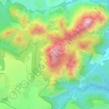
Name: San Estéban topographic map, elevation, terrain.
Location: San Estéban, Zapopan, Jalisco, 45205, México (20.79480 -103.39277 20.79490 -103.39267)
Average elevation: 5,141 ft
Minimum elevation: 4,629 ft
Maximum elevation: 5,807 ft
Other topographic maps
Click on a map to view its topography, its elevation and its terrain.