
Thank you for supporting this site ❤️
Make a donation
Make a donation
Gear up for your next adventure:
As an Amazon Associate, this site earns from qualifying purchases at no extra cost to you.
Thalwil topographic map
Click on the map to display elevation.
Thank you for supporting this site ❤️
Make a donation
Make a donation
Gear up for your next adventure:
As an Amazon Associate, this site earns from qualifying purchases at no extra cost to you.
About this map
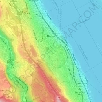
Name: Thalwil topographic map, elevation, terrain.
Location: Thalwil, Bezirk Horgen, Zurich, 8800, Switzerland (47.27273 8.54230 47.30631 8.58966)
Average elevation: 1,545 ft
Minimum elevation: 1,316 ft
Maximum elevation: 2,021 ft
Thank you for supporting this site ❤️
Make a donation
Make a donation
Gear up for your next adventure:
As an Amazon Associate, this site earns from qualifying purchases at no extra cost to you.