
Galatina topographic map
Interactive map
Click on the map to display elevation.
About this map
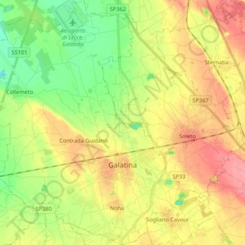
Name: Galatina topographic map, elevation, terrain.
Location: Galatina, Lecce, Pouilles, 73013, Italie (40.13693 18.06882 40.25081 18.21517)
Average elevation: 226 ft
Minimum elevation: 105 ft
Maximum elevation: 351 ft