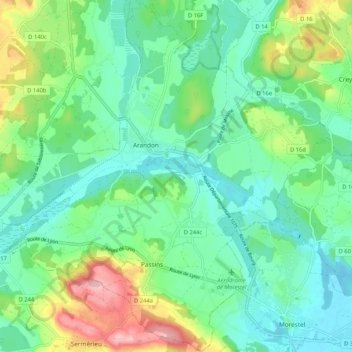
Arandon-Passins topographic map
Interactive map
Click on the map to display elevation.
About this map
Name: Arandon-Passins topographic map, elevation, terrain.
Average elevation: 840 ft
Minimum elevation: 676 ft
Maximum elevation: 1,257 ft

Click on the map to display elevation.
Name: Arandon-Passins topographic map, elevation, terrain.
Average elevation: 840 ft
Minimum elevation: 676 ft
Maximum elevation: 1,257 ft