
Loreto topographic map
Interactive map
Click on the map to display elevation.
About this map
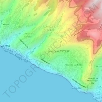
Name: Loreto topographic map, elevation, terrain.
Location: Loreto, Arco da Calheta, Calheta, Madère, 9370-089, Portugal (32.69977 -17.17689 32.73977 -17.13689)
Average elevation: 958 ft
Minimum elevation: 0 ft
Maximum elevation: 3,146 ft