
铁岭县 topographic map
Interactive map
Click on the map to display elevation.
About this map
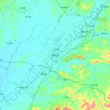
Name: 铁岭县 topographic map, elevation, terrain.
Location: 铁岭县, 凡河镇, 铁岭县, 铁岭市, 辽宁省, 中国 (42.06108 123.56363 42.38108 123.88363)
Average elevation: 295 ft
Minimum elevation: 151 ft
Maximum elevation: 1,411 ft