
Testa del Rutor topographic map
Interactive map
Click on the map to display elevation.
About this map
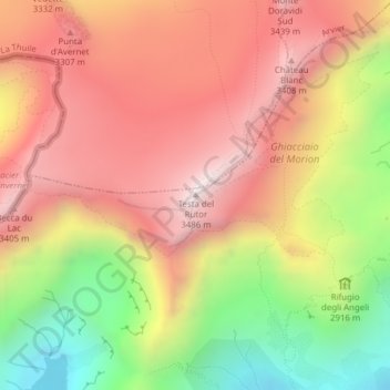
Name: Testa del Rutor topographic map, elevation, terrain.
Location: Testa del Rutor, Valgrisenche, Valle d'Aosta, Italia (45.63067 7.01464 45.63077 7.01474)
Average elevation: 9,931 ft
Minimum elevation: 8,009 ft
Maximum elevation: 11,355 ft