
Province topographic map
Interactive map
Click on the map to display elevation.
About this map
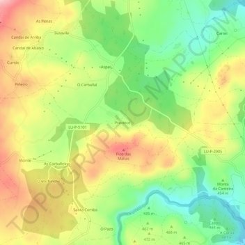
Name: Province topographic map, elevation, terrain.
Location: Province, Lugo, Galizia, 27299, Spagna (43.06055 -7.69039 43.10055 -7.65039)
Average elevation: 1,526 ft
Minimum elevation: 1,243 ft
Maximum elevation: 1,847 ft