
Pope County topographic map
Interactive map
Click on the map to display elevation.
About this map
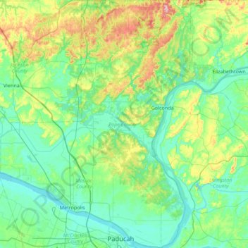
Name: Pope County topographic map, elevation, terrain.
Location: Pope County, Illinois, USA (37.06381 -88.70844 37.60270 -88.40911)
Average elevation: 456 ft
Minimum elevation: 295 ft
Maximum elevation: 1,063 ft
Other topographic maps
Click on a map to view its topography, its elevation and its terrain.
Montague Island
Montague Island, Rockford, Winnebago County, Illinois, 61104, USA
Average elevation: 833 ft
Mount Carmel
USA > Illinois > Mount Carmel
Mount Carmel, Wabash County, Illinois, USA
Average elevation: 420 ft