
Beringen topographic map
Interactive map
Click on the map to display elevation.
About this map
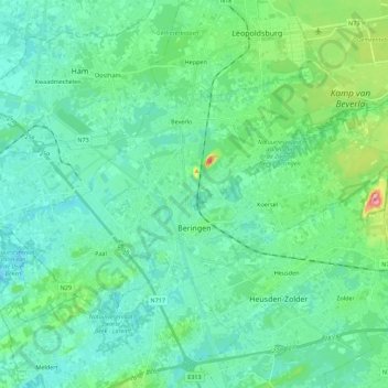
Name: Beringen topographic map, elevation, terrain.
Location: Beringen, Limbourg, Flandre, Belgique (51.01636 5.12162 51.10569 5.34435)
Average elevation: 125 ft
Minimum elevation: 46 ft
Maximum elevation: 463 ft