
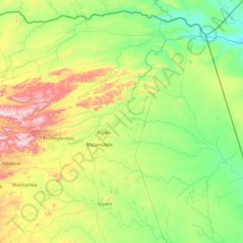
Thulamela Local Municipality topographic map
Interactive map
Click on the map to display elevation.
About this map
Name: Thulamela Local Municipality topographic map, elevation, terrain.
Average elevation: 1,614 ft
Minimum elevation: 591 ft
Maximum elevation: 5,010 ft
Other topographic maps
Click on a map to view its topography, its elevation and its terrain.
Phiphidi Waterfall
South Africa > Limpopo > Thulamela Local Municipality
Phiphidi Waterfall, Thulamela Local Municipality, Vhembe District Municipality, Limpopo, South Africa
Average elevation: 2,572 ft