
Lauterbach topographic map
Interactive map
Click on the map to display elevation.
About this map
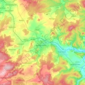
Name: Lauterbach topographic map, elevation, terrain.
Location: Lauterbach, Vogelsbergkreis, Hesse, 36341, Allemagne (50.57726 9.28537 50.70437 9.45378)
Average elevation: 1,227 ft
Minimum elevation: 787 ft
Maximum elevation: 1,722 ft