
Bad Grund topographic map
Interactive map
Click on the map to display elevation.
About this map
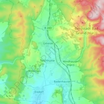
Name: Bad Grund topographic map, elevation, terrain.
Location: Bad Grund, Göttingen (arrondissement), Basse-Saxe, Allemagne (51.75094 10.14256 51.83282 10.26220)
Average elevation: 922 ft
Minimum elevation: 502 ft
Maximum elevation: 1,867 ft