
Le Massif topographic map
Interactive map
Click on the map to display elevation.
About this map
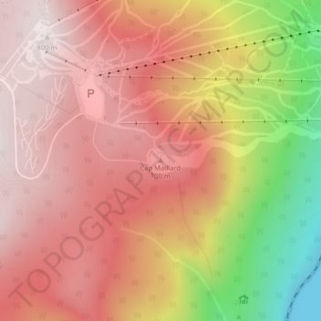
Name: Le Massif topographic map, elevation, terrain.
Average elevation: 1,706 ft
Minimum elevation: 0 ft
Maximum elevation: 2,621 ft
Other topographic maps
Click on a map to view its topography, its elevation and its terrain.
Petite rivière Saint-François
Canada > Québec > Petite-Rivière-Saint-François
Petite rivière Saint-François, Petite-Rivière-Saint-François, Charlevoix, Capitale-Nationale, Québec, G0A 2L0, Canada
Average elevation: 1,444 ft