Geolocate

Tavernier topographic map

Click on the map to display elevation.

About this map

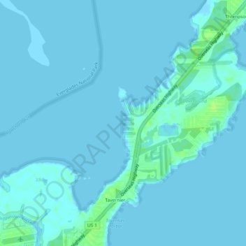
Name: Tavernier topographic map, elevation, terrain.

Location: Tavernier, Monroe County, Florida, 33070, United States (25.00907 -80.54526 25.03979 -80.49970)

Average elevation: 7 ft

Minimum elevation: -7 ft

Maximum elevation: 39 ft

Monroe County trails, hiking, mountain biking, running and outdoor activities

Gear up for your next adventure:

🪶Fire Starter Kit - Reliable fire starter for survival and camping
📶Satellite Messenger - Communication device off‑grid
🖼️Topo Map Wall Art - Decorative topographic prints of famous peaks and regions
🔦LED Headlamp - Bright and durable LED headlamp for night navigation
🪶Camp Gear Gift Set - Perfect gift bundle for outdoor fans

As an Amazon Associate, this site earns from qualifying purchases at no extra cost to you.