
Thank you for supporting this site ❤️
Make a donation
Make a donation
Gear up for your next adventure:
As an Amazon Associate, this site earns from qualifying purchases at no extra cost to you.
Acatenango topographic map
Click on the map to display elevation.
Thank you for supporting this site ❤️
Make a donation
Make a donation
Gear up for your next adventure:
As an Amazon Associate, this site earns from qualifying purchases at no extra cost to you.
About this map
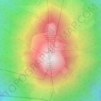
Name: Acatenango topographic map, elevation, terrain.
Location: Acatenango, Chimaltenango, 04001, Guatemala (14.50063 -90.87576 14.50073 -90.87566)
Average elevation: 11,106 ft
Minimum elevation: 9,035 ft
Maximum elevation: 13,028 ft
Thank you for supporting this site ❤️
Make a donation
Make a donation
Gear up for your next adventure:
As an Amazon Associate, this site earns from qualifying purchases at no extra cost to you.