
Thank you for supporting this site ❤️
Make a donation
Make a donation
Gear up for your next adventure:
As an Amazon Associate, this site earns from qualifying purchases at no extra cost to you.
Tuxtla topographic map
Click on the map to display elevation.
Thank you for supporting this site ❤️
Make a donation
Make a donation
Gear up for your next adventure:
As an Amazon Associate, this site earns from qualifying purchases at no extra cost to you.
About this map
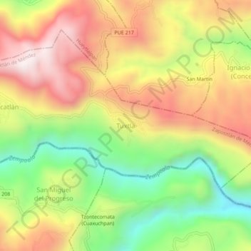
Name: Tuxtla topographic map, elevation, terrain.
Location: Tuxtla, Zapotitlán de Méndez, Puebla, Mexico (19.98056 -97.67444 20.02056 -97.63444)
Average elevation: 2,992 ft
Minimum elevation: 1,594 ft
Maximum elevation: 4,370 ft
Thank you for supporting this site ❤️
Make a donation
Make a donation
Gear up for your next adventure:
As an Amazon Associate, this site earns from qualifying purchases at no extra cost to you.