
Henneckenmoor bei Scheuen topographic map
Interactive map
Click on the map to display elevation.
About this map
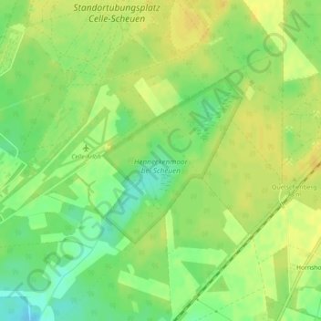
Name: Henneckenmoor bei Scheuen topographic map, elevation, terrain.
Average elevation: 210 ft
Minimum elevation: 161 ft
Maximum elevation: 240 ft
Other topographic maps
Click on a map to view its topography, its elevation and its terrain.
Wietzenbruch
Deutschland > Niedersachsen > Landkreis Celle > Celle
Wietzenbruch, Celle, Landkreis Celle, Niedersachsen, Deutschland
Average elevation: 131 ft