
Melchor Ocampo topographic map
Interactive map
Click on the map to display elevation.
About this map
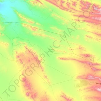
Name: Melchor Ocampo topographic map, elevation, terrain.
Location: Melchor Ocampo, Zacatecas, México (24.67491 -102.46333 25.12524 -101.58339)
Average elevation: 5,820 ft
Minimum elevation: 3,714 ft
Maximum elevation: 10,010 ft