
Unterkotzau topographic map
Interactive map
Click on the map to display elevation.
About this map
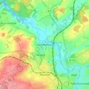
Name: Unterkotzau topographic map, elevation, terrain.
Location: Unterkotzau, Hof, Bayern, 95030, Deutschland (50.31566 11.87703 50.35566 11.91703)
Average elevation: 1,670 ft
Minimum elevation: 1,519 ft
Maximum elevation: 1,893 ft