
Village of Cobleskill topographic map
Interactive map
Click on the map to display elevation.
About this map
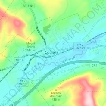
Name: Village of Cobleskill topographic map, elevation, terrain.
Average elevation: 1,132 ft
Minimum elevation: 866 ft
Maximum elevation: 1,844 ft
Other topographic maps
Click on a map to view its topography, its elevation and its terrain.
Howes Cave
United States > New York > Schoharie County > Town of Cobleskill
Howes Cave, Town of Cobleskill, Schoharie County, New York, 12092, United States
Average elevation: 991 ft