
Saint-Saturnin topographic map
Interactive map
Click on the map to display elevation.
About this map
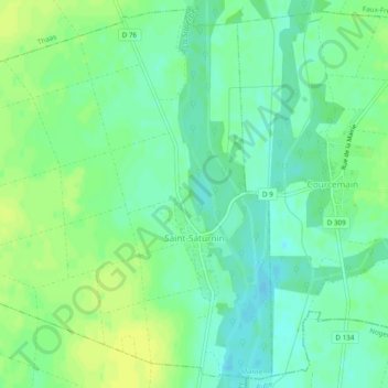
Name: Saint-Saturnin topographic map, elevation, terrain.
Average elevation: 276 ft
Minimum elevation: 249 ft
Maximum elevation: 302 ft
Other topographic maps
Click on a map to view its topography, its elevation and its terrain.
Saint-Remy-sur-Bussy
Saint-Remy-sur-Bussy, Châlons-en-Champagne, Marne, Grand Est, France métropolitaine, 51600, France
Average elevation: 531 ft
Chemin de la Chaussée
France > Grand Est > Marne > Saint-Jean-sur-Moivre
Chemin de la Chaussée, Saint-Jean-sur-Moivre, Châlons-en-Champagne, Marne, Grand Est, France métropolitaine, 51240, France
Average elevation: 430 ft
Mormont
France > Grand Est > Marne > Lisse-en-Champagne
Mormont, Lisse-en-Champagne, Vitry-le-François, Marne, Grand Est, France métropolitaine, 51300, France
Average elevation: 581 ft
Mont Herme
France > Grand Est > Marne > Saint-Brice-Courcelles
Mont Herme, Saint-Brice-Courcelles, Reims, Marne, Grand Est, France métropolitaine, 51370, France
Average elevation: 262 ft
Charleville
France > Grand Est > Marne > Charleville
Charleville, Épernay, Marne, Grand Est, France métropolitaine, 51120, France
Average elevation: 666 ft
Vitry-le-François
France > Grand Est > Marne > Vitry-le-François
Vitry-le-François, Marne, Grand Est, France métropolitaine, 51300, France
Average elevation: 331 ft
Saint-Chéron
France > Grand Est > Marne > Saint-Chéron
Saint-Chéron, Vitry-le-François, Marne, Grand Est, France métropolitaine, 51290, France
Average elevation: 459 ft
Saint-Gilles
Saint-Gilles, Reims, Marne, Grand Est, France métropolitaine, 51170, France
Average elevation: 387 ft
Hautvillers
France > Grand Est > Marne > Hautvillers
Hautvillers, Épernay, Marne, Grand Est, France métropolitaine, 51160, France
Average elevation: 584 ft
Montmort-Lucy
Montmort-Lucy, Épernay, Marne, Grand Est, France métropolitaine, 51270, France
Average elevation: 722 ft
Châtillon-sur-Broué
Châtillon-sur-Broué, Vitry-le-François, Marne, Grand Est, France métropolitaine, 51290, France
Average elevation: 420 ft