
Oradea topographic map
Interactive map
Click on the map to display elevation.
About this map
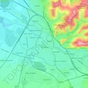
Name: Oradea topographic map, elevation, terrain.
Location: Oradea, Oradea Metropolitan Area, Bihor, Romania (47.01999 21.88643 47.09519 21.99925)
Average elevation: 472 ft
Minimum elevation: 354 ft
Maximum elevation: 843 ft
Other topographic maps
Click on a map to view its topography, its elevation and its terrain.