
Victoria Falls topographic map
Interactive map
Click on the map to display elevation.
About this map
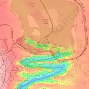
Name: Victoria Falls topographic map, elevation, terrain.
Location: Victoria Falls, Livingstone, Southern Province, Zambia (-17.92447 25.85392 -17.92445 25.85424)
Average elevation: 2,871 ft
Minimum elevation: 2,487 ft
Maximum elevation: 3,025 ft
Other topographic maps
Click on a map to view its topography, its elevation and its terrain.
Victoria Falls
Zambia > Southern Province > Livingstone
Victoria Falls, Livingstone, Livingstone District, Southern Province, Zambia
Average elevation: 2,871 ft
Victoria Falls
Zambia > Southern Province > Livingstone
Victoria Falls, Livingstone, Southern Province, Zambia
Average elevation: 2,877 ft