
Moquegua topographic map
Interactive map
Click on the map to display elevation.
About this map
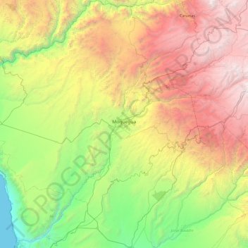
Name: Moquegua topographic map, elevation, terrain.
Location: Moquegua, Mariscal Nieto, Moquegua, Pérou (-17.64946 -71.44096 -16.75336 -70.57251)
Average elevation: 6,824 ft
Minimum elevation: 0 ft
Maximum elevation: 17,956 ft