
Hacılar topographic map
Interactive map
Click on the map to display elevation.
About this map
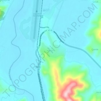
Name: Hacılar topographic map, elevation, terrain.
Location: Hacılar, Çaycuma, Zonguldak, Black Sea Region, Türkiye (41.47304 32.07633 41.51304 32.11633)
Average elevation: 128 ft
Minimum elevation: 16 ft
Maximum elevation: 840 ft