
Chãs Grandes topographic map
Interactive map
Click on the map to display elevation.
About this map
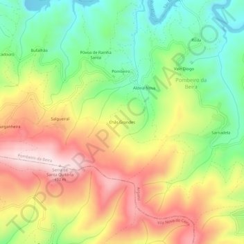
Name: Chãs Grandes topographic map, elevation, terrain.
Location: Chãs Grandes, Pombeiro da Beira, Arganil, Coimbra, Portugal (40.19830 -8.15738 40.23830 -8.11738)
Average elevation: 948 ft
Minimum elevation: 367 ft
Maximum elevation: 1,601 ft
Other topographic maps
Click on a map to view its topography, its elevation and its terrain.
Covais
Portugal > Coimbra > Pombeiro da Beira
Covais, Pombeiro da Beira, Arganil, Coimbra, 3300-405, Portugal
Average elevation: 607 ft