
Shinile topographic map
Interactive map
Click on the map to display elevation.
About this map
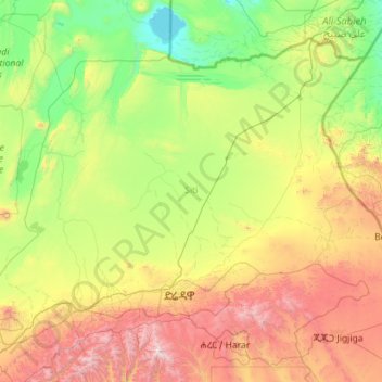
Name: Shinile topographic map, elevation, terrain.
Location: Shinile, Somali, Äthiopien (9.30726 40.69511 11.09558 42.96164)
Average elevation: 3,297 ft
Minimum elevation: 784 ft
Maximum elevation: 10,906 ft
Other topographic maps
Click on a map to view its topography, its elevation and its terrain.