El Merdj Ouaman topographic map
Interactive map
Click on the map to display elevation.
About this map
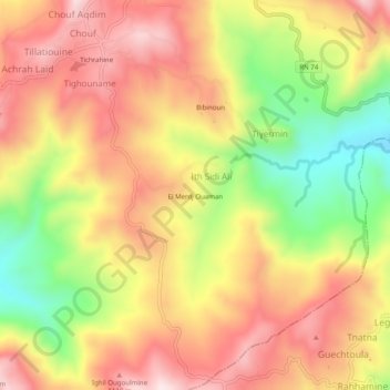
Name: El Merdj Ouaman topographic map, elevation, terrain.
Average elevation: 3,248 ft
Minimum elevation: 2,398 ft
Maximum elevation: 3,901 ft

Click on the map to display elevation.
Name: El Merdj Ouaman topographic map, elevation, terrain.
Average elevation: 3,248 ft
Minimum elevation: 2,398 ft
Maximum elevation: 3,901 ft