
Lago dell'Argentera topographic map
Interactive map
Click on the map to display elevation.
About this map
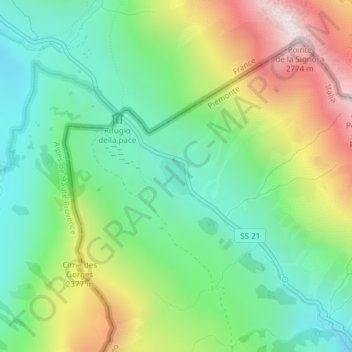
Name: Lago dell'Argentera topographic map, elevation, terrain.
Average elevation: 7,133 ft
Minimum elevation: 6,076 ft
Maximum elevation: 9,052 ft
Other topographic maps
Click on a map to view its topography, its elevation and its terrain.
Col de Larche
Col de Larche, Strada Statale 21 della Maddalena, Argentera, Coni, Piémont, Italie
Average elevation: 6,962 ft