Geolocate

Bingley topographic map

Click on the map to display elevation.

About this map

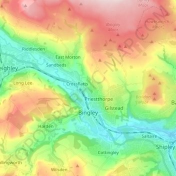
Name: Bingley topographic map, elevation, terrain.

Location: Bingley, Bradford, West Yorkshire, England, United Kingdom (53.81866 -1.87937 53.89957 -1.76091)

Average elevation: 650 ft

Minimum elevation: 210 ft

Maximum elevation: 1,253 ft

Other topographic maps

Click on a map to view its topography, its elevation and its terrain.

High Utley

United Kingdom > England > Bradford > Keighley

Average elevation: 554 ft

Gear up for your next adventure:

GPS Sports Watch - GPS watch for running, hiking and training
🚗GPS Dash Cams - Record your scenic drives through mountain passes and canyons
🧣Hiking Neck Gaiter - Multi‑use neck protection for outdoor weather
📖Nature Tracking Books - Learn to track wildlife and terrain
📡Handheld GPS Device - Reliable handheld GPS for outdoor navigation

As an Amazon Associate, this site earns from qualifying purchases at no extra cost to you.