
Thank you for supporting this site ❤️
Make a donation
Make a donation
Gear up for your next adventure:
As an Amazon Associate, this site earns from qualifying purchases at no extra cost to you.
Chillca topographic map
Click on the map to display elevation.
Thank you for supporting this site ❤️
Make a donation
Make a donation
Gear up for your next adventure:
As an Amazon Associate, this site earns from qualifying purchases at no extra cost to you.
About this map
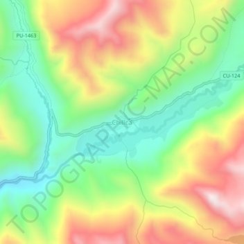
Name: Chillca topographic map, elevation, terrain.
Location: Chillca, Pitumarca, Province of Canchis, Cusco, Peru (-13.90224 -71.24666 -13.86224 -71.20666)
Average elevation: 14,888 ft
Minimum elevation: 13,898 ft
Maximum elevation: 16,181 ft
Thank you for supporting this site ❤️
Make a donation
Make a donation
Gear up for your next adventure:
As an Amazon Associate, this site earns from qualifying purchases at no extra cost to you.