
Villauret topographic map
Interactive map
Click on the map to display elevation.
About this map
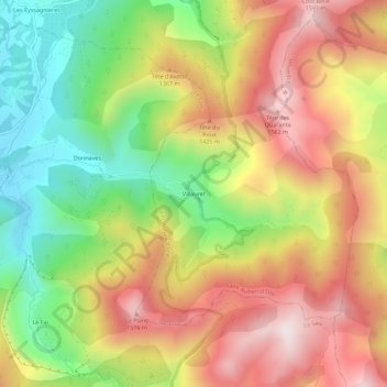
Name: Villauret topographic map, elevation, terrain.
Average elevation: 3,983 ft
Minimum elevation: 2,680 ft
Maximum elevation: 5,269 ft
Other topographic maps
Click on a map to view its topography, its elevation and its terrain.
Les Eyssagnières
France > Provence-Alpes-Côte d'Azur > Hautes-Alpes > Saint-Auban-d'Oze
Les Eyssagnières, Saint-Auban-d'Oze, Gap, Hautes-Alpes, Provence-Alpes-Côte d'Azur, France métropolitaine, 05400, France
Average elevation: 3,248 ft