
Hoekelum topographic map
Interactive map
Click on the map to display elevation.
About this map
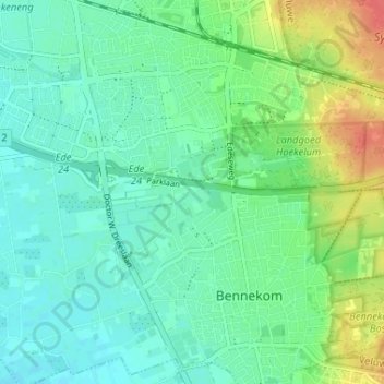
Name: Hoekelum topographic map, elevation, terrain.
Average elevation: 69 ft
Minimum elevation: 20 ft
Maximum elevation: 184 ft
Other topographic maps
Click on a map to view its topography, its elevation and its terrain.
De Kraats
Nederland > Gelderland > Bennekom
De Kraats, Bennekom, Ede, Gelderland, Nederland, 6721 NJ, Nederland
Average elevation: 33 ft
Landgoed Hoekelum
Nederland > Gelderland > Bennekom
Landgoed Hoekelum, Bennekom, Ede, Gelderland, Nederland, 6721KE, Nederland
Average elevation: 98 ft