
Skamokawa topographic map
Interactive map
Click on the map to display elevation.
About this map
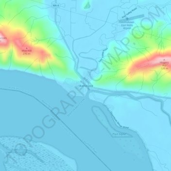
Name: Skamokawa topographic map, elevation, terrain.
Average elevation: 128 ft
Minimum elevation: -7 ft
Maximum elevation: 1,070 ft
Other topographic maps
Click on a map to view its topography, its elevation and its terrain.
Whites Island
United States > Washington > Wahkiakum County
Whites Island, Wahkiakum County, Washington, United States
Average elevation: 72 ft
Grays River
United States > Washington > Wahkiakum County
Grays River, Wahkiakum County, Washington, 98643, United States
Average elevation: 869 ft