
Branderschrofen topographic map
Interactive map
Click on the map to display elevation.
About this map
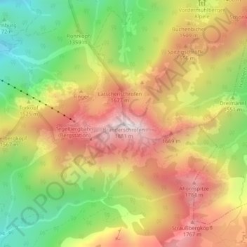
Name: Branderschrofen topographic map, elevation, terrain.
Average elevation: 4,669 ft
Minimum elevation: 3,169 ft
Maximum elevation: 6,102 ft
Other topographic maps
Click on a map to view its topography, its elevation and its terrain.
Bleckenau
Deutschland > Bayern > Landkreis Ostallgäu > Schwangau
Bleckenau, Schwangau, Landkreis Ostallgäu, Bayern, Deutschland
Average elevation: 4,708 ft
Horn
Deutschland > Bayern > Landkreis Ostallgäu > Schwangau
Horn, Schwangau, Landkreis Ostallgäu, Bayern, 87645, Deutschland
Average elevation: 2,664 ft