
Lake Kitangiri topographic map
Interactive map
Click on the map to display elevation.
About this map
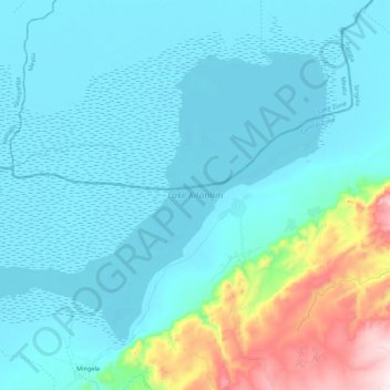
Name: Lake Kitangiri topographic map, elevation, terrain.
Location: Lake Kitangiri, Iramba, Singida, Central Zone, Tanzania (-4.17097 34.15973 -4.00976 34.37781)
Average elevation: 3,694 ft
Minimum elevation: 3,396 ft
Maximum elevation: 5,348 ft