
福贡县 topographic map
Interactive map
Click on the map to display elevation.
About this map
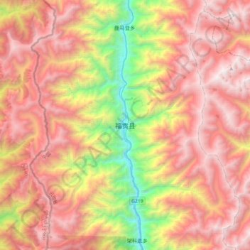
Name: 福贡县 topographic map, elevation, terrain.
Location: 福贡县, 上帕镇, 福贡县, 怒江傈僳族自治州, 云南省, 中国 (26.74577 98.70785 27.06577 99.02785)
Average elevation: 9,583 ft
Minimum elevation: 3,704 ft
Maximum elevation: 14,423 ft