
Wolferborn topographic map
Interactive map
Click on the map to display elevation.
About this map
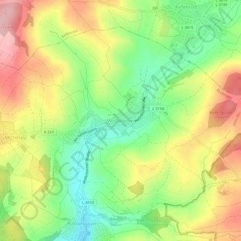
Name: Wolferborn topographic map, elevation, terrain.
Location: Wolferborn, Büdingen, Wetteraukreis, Hessen, Deutschland (50.31707 9.17362 50.34379 9.22737)
Average elevation: 974 ft
Minimum elevation: 712 ft
Maximum elevation: 1,266 ft